


The maps of the atlas are interconnected so that the user may click into an area which is represented by another map (offering better resolution). Clicking into the outline of another map (red lines in figure above) triggers the display of the connected map. For more details please visit the online help pages.
The component TGeoAtlas is part of the GeoPack.
| Atlas | 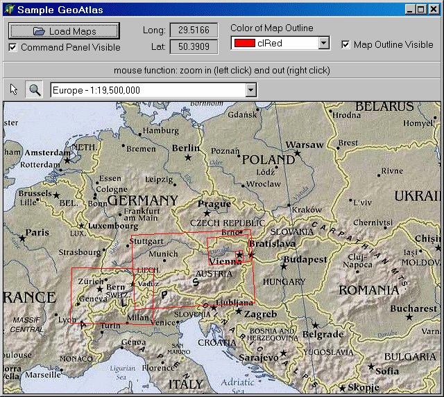 Shows
how to use the component TGeoAtlas. Several calibrated maps of Europe, Austria and Switzerland are come along with this application. You can zoom into the area of Vienna. Sources of the sample program included (Delphi 6). Shows
how to use the component TGeoAtlas. Several calibrated maps of Europe, Austria and Switzerland are come along with this application. You can zoom into the area of Vienna. Sources of the sample program included (Delphi 6). |
atlas.zip
(4.69 MB) |
What's new:
- Release 12.1 [Sep-30, 2025]
- no changes
- Release 12.0 [Dec-12, 2023]
- no changes
- Release 10.7 [Aug-24, 2020]
- no changes
- Release 10.6 [Mar-09, 2018]
- no changes
- Release 10.5 [Oct-10, 2016]
- no changes
- Release 10.4 [Jun-02, 2015]
- no changes
- Release 10.3 [Oct-06, 2014]
- none
- Release 10.2 [May-30, 2013]
- no changes
- Release 10.1 [Oct-29, 2012]
- no changes
- Release 10.0 [Oct-4, 2011]
- bug fix: default width and height are now correct
- Release 9.7 [May-31, 2010]
- no changes
- Release 9.51 [Dec-01, 2008]
- no changes
- Release 9.5 [Oct-31, 2008]
- no changes
- Release 9.0 [May-28, 2007]
- no changes
- Release 8.5 [Feb-18, 2006]
- GEOATLAS is now available in the Light Edition of the SDL Suite
- Release 8.2 [Nov-03, 2004]
- no changes
- Release 8.1 [Aug-29, 2004]
- available for Delphi™ 8 for .NET
- Release 8.0 [Apr-15, 2004]
- no changes
- Release 7.2 [Mar-23, 2003]
- first release to the public as part of the SDL GeoPack;
- available for Delphi™ 4.0 to 7.0 and C++Builder™ 4 to 6